
September 8, 2019, Day 4
Wild Rose Reservoir to Owyhee River (OC 129), ~26.3 miles, ~69 miles total
Gabriel’s Day 4 pictures are here.
We got up an hour earlier than we have been to ensure we’d make it to the next reliable water source. Headlamp walking the first half hour with jackrabbits hopping about. Around dawn overcast skies hardly revealed the sunrise.
Such contrast to our friends DNR and Dan walking across this same stretch of country two weeks earlier in 100+ degree temps. We kept our wind shirts on for several hours of 50 degree climes with rain showers. (So far, it rains 3 out of every 4 days on the ODT.)
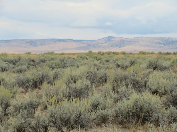
We trotted along little used roads amid sagebrush and bunchgrasses. Long sightlines with horizons of blue gray cloudy skies intermixed with sage greens and golden grasses. Song birds singing sweetly (sage sparrows maybe?) amid the sage and yellow-flowered rabbitbrush.
Highlights of the morning included unexpected 4G at breakfast and watching turkey vultures take flight from the corral at Birch Spring Ranch.
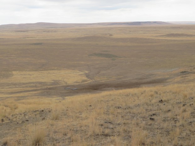
A couple hours and more miles later the clouds burned off and we had views of Owyhee Canyon, Saddle Mountain, Steens (explains the 4G), the Pueblos, Trout Creek and Oregon Canyon Mountains, and many more mountains. Gabriel and I realized that we were looking west at the hills beyond Big Sand Gap off the Alvord Desert. Four years ago we’d been there with DNR and wondered what was east of the low sandy hilly mountains. Now we have an idea. This trip is helping us make acquaintance with parts of southeast Oregon. To know what’s on the proverbial other side.
(Pictures from our visit to Big Sand Gap in October 2015 can be found here: https://www.yellowleaf.org/scramble/g/r/2015-10-04-alvord.html)
When Iron Point came into view we knew we were getting close to our descent into Owyhee Canyon. A beautiful green ribbon along the blue waters of Owyhee River. New terrain. Water beckoning.
We hopped a rusty barbed wire fence and made our way down to an old jeep track. Warm road miles along an old military wagon road amid the lava formations of Lambert Rocks. Bogus Creek was cool and refreshing to dip our sungloves in (but we didn’t pick up any water based on DNR’s water beta that it tasted less than desirable). The private land near by the creek was brimming with tall green cottonwoods that almost seemed to be a mirage in the late afternoon sun and shadows.
We kept walking and made it down to the banks of the Owyhee River around 7 pm. Canyon wrens welcomed us to the peaceful river scene. Sunflowers danced in a gentle breeze off the water. The sound of the river and fragrance of riparian vegetation reminded us a bit of camping in the Grand Canyon on last year’s river trip.
We collected water for the 23 miles to Rome. Not knowing if we’ll be able to make the cross country miles in good time, so we want to be on the prepared side and have water for a dry camp. Oof. Collecting water, treating water. It’s the critical thing to do in the desert.
Water treating, we enjoyed dinner with the sun setting over the Owyhee Canyon, bats flying about, and the stars flickering into the night sky.
Footsore after a marathon of miles, but what a reward for hoofing it to get here!

Dawn walking across the berm of a dry reservoir.

Golden bunch grass and gray blue skies. Such horizons! I wonder if Rothko was inspired by landscapes of the Basin and Range.

Breakfast time amid volcanic rocks. Somewhere beyond the clouds, Steens Mountain rises above the rest of eastern Oregon and thus (surprisingly) providing 4G cell service. Photo by Gabriel Deal
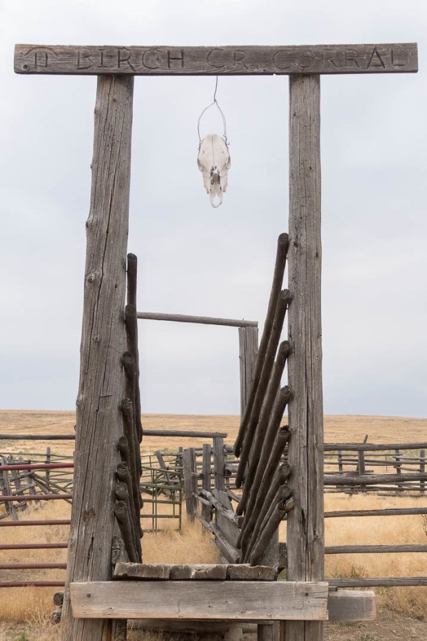
The corral at Birch Creek. Photo by Gabriel Deal

A young turkey vulture at Birch Creek corral.

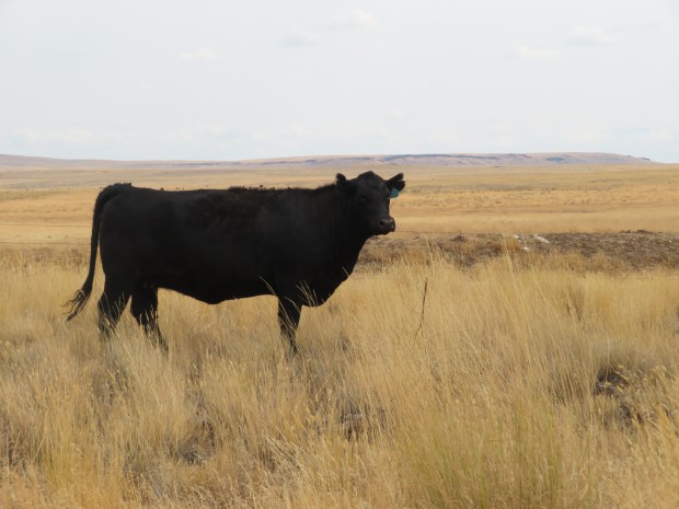
Everything is better with cows around, except when they start to follow you down the road. Photo by Gabriel Deal
Descending down to Owyhee Canyon. Photo by Gabriel Deal

Looking down at the beautiful ribbons of green and blue. Photo by Gabriel Deal

Sunflowers and the Owyhee River near camp. Photo by Gabriel Deal

Fetching water. Photo by Gabriel Deal

Home sweet home for the night and treating tomorrow’s water. Photo by Gabriel Deal
Pictures from my camera – added to this post in April 2020.

Up and moving on a cool morning – we needed our wind shirts. When DNR & Dan came through here two weeks earlier it was a 100 degrees! Same “trail”, different day.

Looking back south to Mahogany Mountain.

Turkey vultures circling Birch Creek Corral.
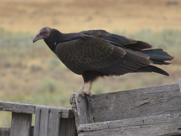
Juvenile turkey vulture.

A sea of sagebrush green and cloudy muted blue skies. Rothko-like horizon.
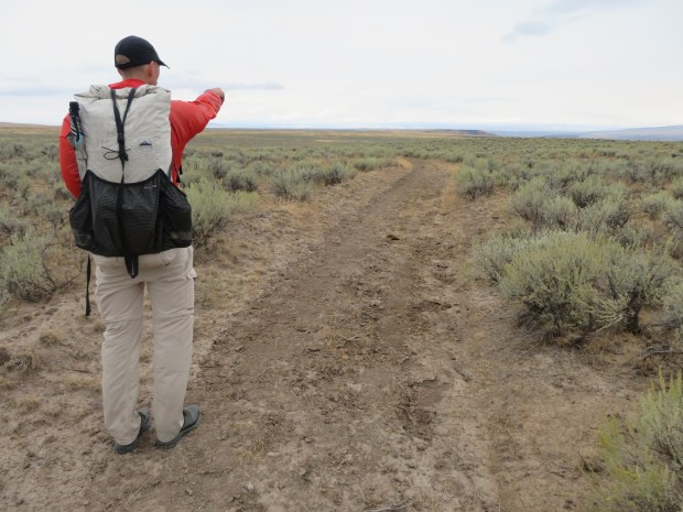
Hours of road walking can dull the senses at times. Here we see something in the distance and start to make all sorts of guesses as to what human made object is out here. I’m hoping for a lemonade and hot cocoa stand.

Finally made it to the distant thing. It’s a dry cattle trough. No hot cocoa, no lemonade. Le sigh.
Walking along the Owyhee Uplands one travels through a lot of sagebrush country. Sometimes you can crouch low to get out of the wind. Sometimes the sage sparrows and other birds sing a tune. There’s lots happening underneath the shrubs, in the bunchgrass, and biocrust.

Sometimes the sagebrush steppe feels more like rangeland with cropped grasses, busted biocrusts, and cowpies aplenty.

And sometimes on the opposite side of the road or other side of the fence the bunchgrasses look like this.
The “well-cropped” (is this overgrazed?) rangeland spans miles of country with the hardest “cow hammer” to the land most evident around a water source like this reservoir.

Cattle hoof prints dent the ground and do make good cup holders. No need to mind the dried out cattle dung – it’s just the cow stamp of approval for our break spot.
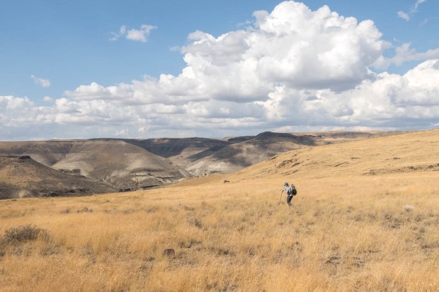
A fellow hiker.

Heading southwest toward Iron Point and Owyhee Canyon.
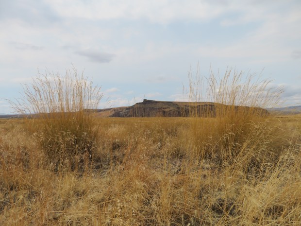
Looking west across Owyhee Canyon to Iron Point and some tall grasses.

Approaching the line for descending into the Canyon.
-

The Owyhee River – a beautiful blue and green ribbon. Riparian habitats like this corridor often provide essential resources to sustain upland wildlife and are hotspots of biodiversity within shrub-steppe environments.
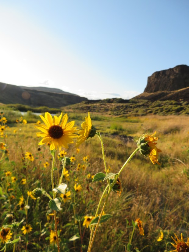
Sunflowers aglow on the bench above the Owyhee River near Lambert Rocks.

Cloud shows and lava rocks on the benches above the Owyhee River. An old military wagon road provides our track.

Coyote walked here.
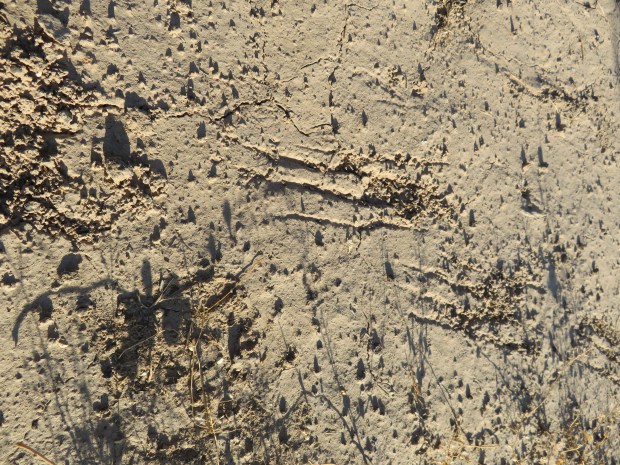
Badger walked here too. The scrapes of long powerful digging claws. Wilson Wewa tells some fine Northern Paiute stories about Badger in Legends of the Northern Paiute.
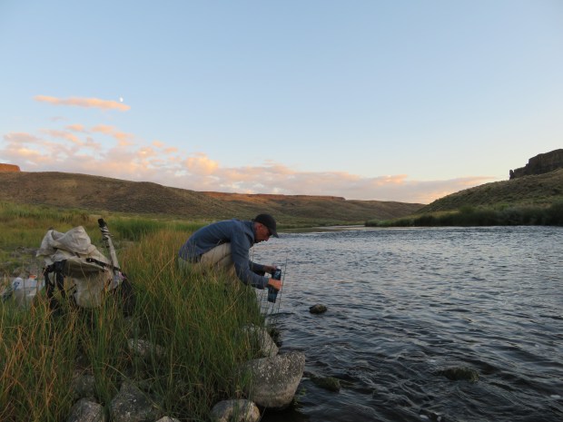
Moon rising as Gabriel collects water for tomorrow.

Peaceful evening along a gentle flowing stretch of the Owyhee. Oh the smell of the river and its banks: fish, algae, willows and sedges. It is the scent of abundant life!
