
September 9, 2019, Day 5
Owyhee River (OC 129) to Rome, OR, ~22.2 miles, ~91.2 miles total
Gabriel’s Day 5 pictures are here.
Around 2:00 am a rain cell moved over us as we slept out under the stars. Our cowboy camp was getting wet in a hurry. We groggily snapped up the mid in a couple of minutes. A new experience to see stars in the sky but one dark rain cloud above us raining hard. (So far it rains 4 out of 5 days on the ODT.)
Getting up at 6:30, the stars were still out and Orion was in the eastern sky. A beautiful, peaceful morning in Owyhee Canyon. We picked up camp, admired the river a little more, and headed the half-mile back up to the old wagon road.
Time to get back to the uplands above the canyon. Good bye plentiful water, but hello easy walking. We had some cross country to do. It’s not hard moving through this landscape but there are all sorts of micro navigational to-do’s, not limited to but including:
- don’t step on the biocrust soil (and there is some here!),
- watch for snakes in shrubs and grass,
- stay out of each other’s tracks to minimize impact,
- don’t smush the praying mantis,
- try not to walk into large spider webs with silver dollar-sized gold and black spiders (yellow garden spider?), and
- avoid the trippy roley lava rocks.
All the while there’s the larger navigational to-do’s of follow your baring in an efficient manner. It can be hard to take in the landscape when one is concentrating on maneuvering through the landscape.
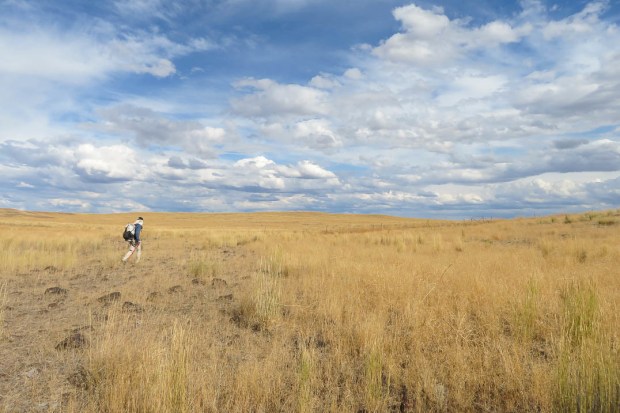
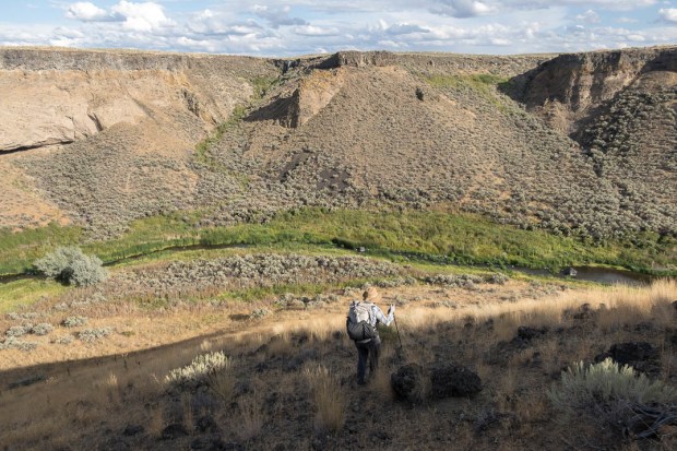
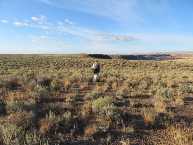
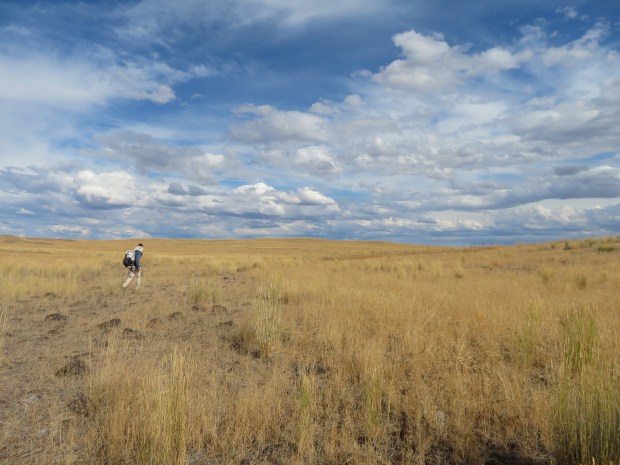
We topped out on the rim and set out cross country. Around some areas the soil and vegetation looks much less disturbed. More bunchgrasses, shrubs, and biocrusts, the footing softer; it feels less compacted. We felt a little guilty walking along through the small sagebrush plant community and kept our footsteps light. It feels wrong to add compaction to a place like this when so much of the landscape around it is heavily impacted.
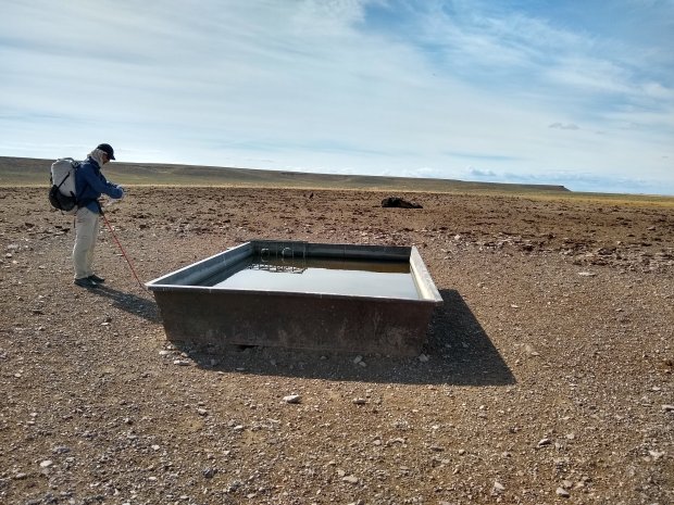
An hour or so later we were at out next landmark, a dried up cattle reservoir and we no longer felt the need to walk softly. The ground is hard, cheatgrass abounds, and cows have, well, cow-afied the area around the water tanks. We did a bit more cross country and when we were near point OC 123 on our maps, we remembered what Allgood said about taking a road vs going cross country along the rim. The rim is beautiful, but we didn’t want to make foot prints on sensitive ground and wanted our minds free to look at the scenery. We headed for the road walked by some neat lava vents/caves along the way and then cruised along meeting up with the ODT around OC 117.
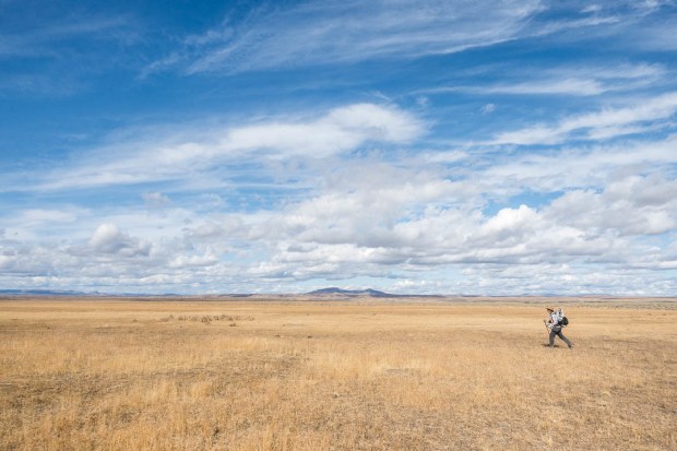
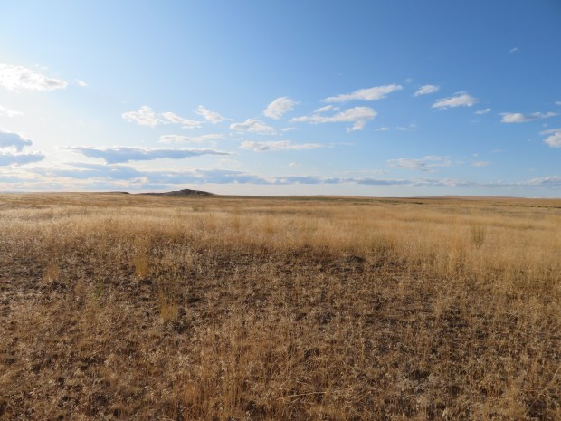
Early afternoon and we were starting the 3.3 mile straight shot on a 100 degree baring across bunchgrass slopes to Jordan Creek Canyon. Miles of bunchgrass. Views to the north of Owyhee Butte – a black volcanic rock crown amid a field of golden grass, views in the distance of mountains, and irrigated crop lands (civilization is near!).
Somewhere in the afternoon walking we unspokenly decided to go for Rome. We had cell service and called Rome Station only to be told the cabins were full. Gabriel seemed disappointed and it was then that I noticed his limp and put together his sore foot was really bothering him. We kept our pace easy, but kept moving. Jack rabbits flushed ahead of us and we watched the black-tailed experts navigate the bunchgrass slaloms with ease.
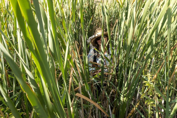
At last we got to the the imposing looking basalt walls of Jordan Creek Canyon. Some 200 feet down below was the creek we needed to cross. It meandered through cattails, tule rushes, and teasels. From up above we knew the route would funnel us to a good descent route. Descending 50 or so feet, we took a break in the canyon shade to get ready for the final push to Rome.
In the 1860’s someone found gold and silver in Jordan Creek and that started a prospecting boom that spurred demand for beef, drawing cattlemen with their herds. In the 1880s, Basque shepherds with their flocks of sheep came to this here part of the world. Cattle resumed their reign in the 1930s. Interesting to think about how the landscape has changed in a mere 150 years and continues to change. Oh how to navigate history?
But we wanted to get to Rome. So we focused on carefully stepping down the pea gravel slope (Gabriel with sun umbrella out), crossed the creek, pushed through cattails for about a minute of mucky schwacking (Cascade scramble ducks say schwack schwack!), and climbed up out of the canyon negotiating barbed wire and looking for rattlesnakes under the dusty sagebrush.
Onto to an old road, we got to Highway 95 around 7:15. Footsore and tired, we’d maybe make it to Rome Station before they closed. But if we missed it, well at least we’d pick up our resupply boxes first thing in the morning. We hoofed it along the road, thankfully with a good shoulder. Semis roaring by, but a pretty sunset. Such contrast to the peaceful evening sounds of the last four nights. (River lapping at the shore, coyotes, crickets, rain on tent walls.)
Alas, we got to Rome Station around 8:03 and the little store was closed. We stumbled over to a camp site in the grass behind the store. Gabriel crashed pretty hard for about an hour sleeping on the picnic table with his food bag for a pillow and his sleeping bag to stay warm. I set up the tent and got things arranged. Eating dinner by moonlight, noting I still had 2-3 days of food (ugh), and just enough water if we’d had to dry camp before making town. Some things we are starting to dial in.
Tomorrow it’s supposed to rain hard and storm. Hopefully we can stay here in Rome under cover and rest up. But that’s for figuring out tomorrow.

Camp in Owyhee Canyon at dawn. Photo by Gabriel Deal
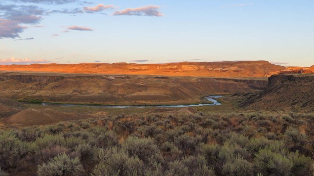
Sunrise over Owyhee Country. Photo by Gabriel Deal
Crossing a land of cheatgrass and pepperweed near a cattle trough. Photo by Gabriel Deal

Cow-afied lands surrounding a cattle trough.
Unexpected water next to a dead steer with turkey vultures standing guard. We decided to pass on the bonus water at this cattle trough.

These little mace-like seed is a goathead. They make rolling under barbed wire fences a much more arduous process. The spines pierce through sun gloves and other clothes drawing blood and inflaming the skin. Apparently they can also pop car tires. So small, so powerful!

Cow-afied lands where the sagebrush was mowed, burned, or somehow mechanically cleared out. Cause you know this makes for “better” rangeland for cows. I question the use of this practice, it doesn’t seem like good stewardship to me.

Happy cross country walking above the canyon rim in areas with healthier vegetation, but where we need to be careful to tread lightly.

A fence challenge! There was so much tumble mustard blocking the lower part of the fence that we had to climb over. Make sure your tetanus shot is current before heading out on the ODT! Photo by Gabriel Deal
Gabriel walks along a 100 degree baring.
- Descending down to Jordan Creek. Photo by Gabriel Deal
Cattails schwack schwack!

Good shoulder along US Route 95 aka the ION Highway. ION is Idaho-Oregon-Nevada. Photo by Gabriel Deal

Made it to Rome! But just after closing.
Pictures from my camera – added to this post in April 2020.
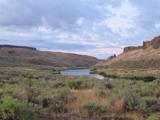
Morning along the Owyhee River.
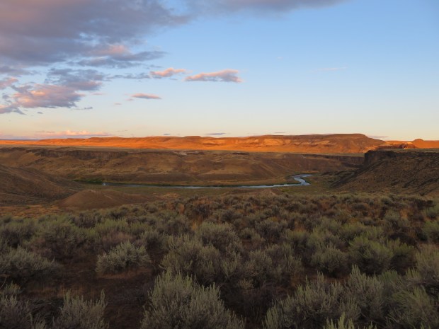
First rays of sun warm up the canyon as we hike along the bench toward the canyon rim.
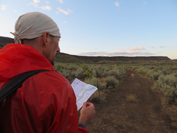
Map studying.
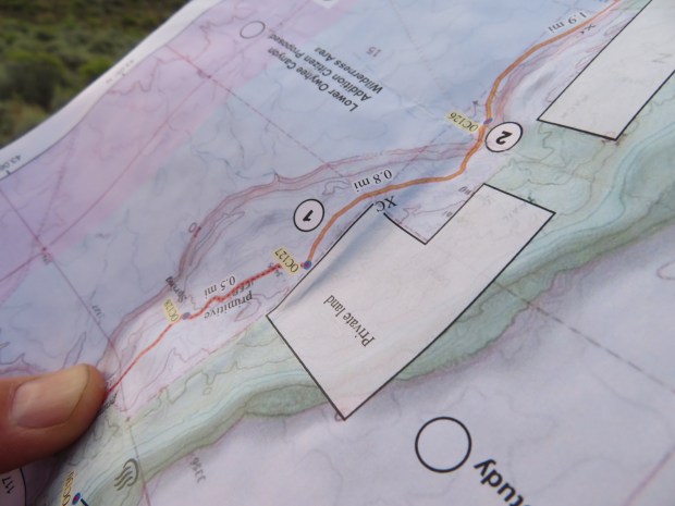
We look at a lot of the maps upside down or backwards because we are traveling east to west along the ODT and the maps are geared for moving west to east. It can be a little confusing at times.

Somewhere up there is an old military wagon road that leads out of the canyon. To get there involves cross country negotiation of sagebrush, biocrust, avoiding each others tracks, spider webs, and lava rocks. Not hard to do, but not easy moving like on a road, trail, or consolidated snow.
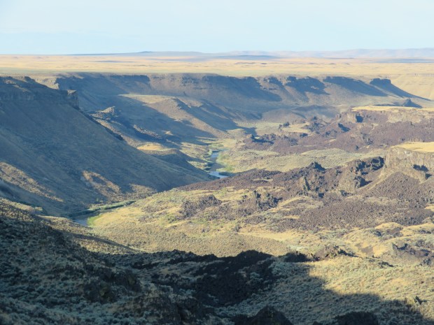
Now on the rim, looking back at the Owyhee River at the volcanic flows known as the Lambert Rocks.
So much to look at in this short sagebrush landscape!
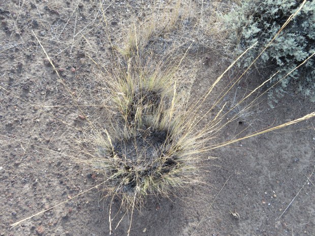
Old-growth bunch grass.
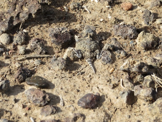
Short horned lizard!
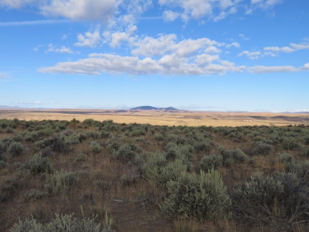
Saddle Butte on the other side of Owyhee Canyon.

Water and a dead steer. Glad we didn’t arrive at this trough feeling thirsty.

Lava vents are scattered across the landscape – reminders of the volcanic activity that shaped the plateau.
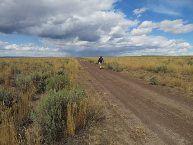
Road walkin’.

An exciting roadside attraction.

Long-nosed leopard lizard!

Fence negotiating. There was too much tumble mustard piled up along this fence to roll underneath it.

Taking a baring for some 3 miles of straight line walking.
Walking amid the bunchgrasses – not sure what type.

Gabriel approaches Jordan Creek.

Descending down to Jordan Creek. I thought it was a little loose and the going warranted both my trekking poles. Gabriel thought it warranted a sun umbrella.

Jordan Canyon – time to get across it.

Finding a spot to ford the creek.

We may have picked a shallow spot to wade across, but we chose poorly as far as vegetation to push through to get to dry ground. Look at all those cat tails ahead!

Going through the cat tails.
After all the wet and mud, at the top of the canyon it’s back to dry flat land walking.

Made it to Highway 95 – also known as I.O.N. Highway in these parts (aka Idaho, Oregon, Nevada).
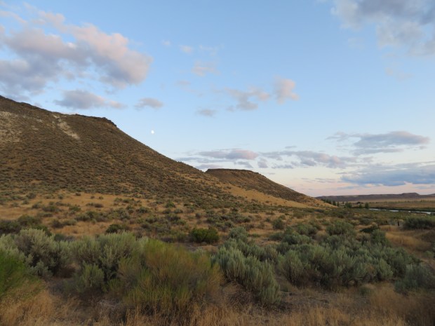
Moonrise over the Owyhee Uplands. We’ll be headed up these hills when we get back on the ODT in a few days.
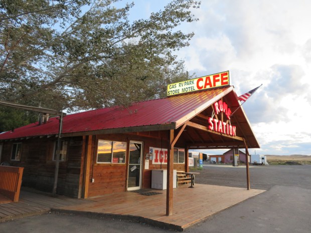
Rome Station! Cafe, gas station, camping and cabins. All the civilization one needs – and can handle – after the last few days. It’s a lovely little oasis after a long day.
