
September 22, 2019, Day 18
Harney-Malheur County Line to Dry Creek (west of Little Windy Pass), ~23.0 miles, ~259.6 miles total
Gabriel’s Day 18 pictures are here.
First day of autumn. Yabano as the fall season is known in Northern Paiute. My guidebooks for the region mention that these mountains are home to hundreds of sites of significance to the Paiute; some having withstood a thousand years of weathering as well as 160 years of intentional disturbance. I think about the people who have lived here in this part of the Basin and Range since time immemorial. Every rock outcrop we pass, I wonder, and sometimes circle, searching, hoping to find Coyote Writings, etsatubono, petroglyphs carved into the rocks. I wish to look out at this landscape with more understanding; with wisdom grounded in traditional knowledge that goes beyond the science of ecology – though often they compliment each other.
My eyes are untrained, and so I wonder if everything is sacred. If everywhere there are signs of the significance of these trees, these streams, plant peoples, animal peoples, rocks, mountains. I especially think about these relationships, signs and knowledge as we walk on this day that marks the start of fall. The start of hunting season, the end of berry gathering, and the approach of winter’s storytelling time.
For the last week and a hundred miles, we’ve been feeling autumn. Chillier mornings, a coolness in the afternoon when summer’s heat would otherwise build, frost diamonds sparkling in moonlight.
We woke up to our headlamps reflecting the glitter of ice crystals this cold, autumn morning on the edge of the Trout Creek Mountains. Frosted tent. Numb fingers packing up. Breath fogging our headlamps. We were moving out of our beautiful camp just before sunrise, ascending a gentle jeep road into the mountains.
Oh all those chills and discomforts are worth it.
What a magnificent sunrise! What a gift for this equinox. Day that is half light and half dark. Hillside aglow in pink gold illuminating tall grasses, silver silhouettes of burned mahogany, and radiant mahogany in full stature. Birdsong chorusing out of bunchgrass and rabbitbrush thickets. Welcome autumn! Welcome yabano.
Hiking up to the 8,000 foot ridge of the Trout Creek Mountains we had clear views of Steens Mountain and peekaboo views of the Alvord Playa and Pueblo Mountains. The Trout Creek Mountains we walk across are a broad plateau of short sagebrush and bunchgrasses, expansive in composition and views. While walking the road we flushed grouse more than a hundred feet away. The sounds of their awkward chicken flight starling us as they burst out of the sage and delighting us as they gain lift. These birds are pretty amazing, they’re adapted to live in this cold, hot, dry, wind-scoured, snowy world. Go sage grouse, we wish you well!
Cold ridge walking. Patches of snow. A few nods and waves from hunters driving loaded rigs and trailers up the road, they are headed into the hills to set up their camps. From the looks of their loads, they are going to be living well up here! Opening day is less than a week away (September 28, also National Hunting Day). My best to the hunters and to the deer. As for hiking and traveling cross country during hunting season, I’m glad we have blaze orange accessories and wear bright colors; we’ll do our best to avoid being mistaken for ungulates.
It was mostly an easy, pretty walking day. Plenty of opportunity to admire the early autumn colors: golden-green aspen, ruby red rose hips, orange and red dappled snowberry, last of the season red paintbrush, plump shiny black chokecherries, golden rabbitbrush. A beautiful fall day of good hiking. The afternoon was even warm enough for us to shed our insulating layers.
But the character of the day and my perceptions of it changed mid-to-late afternoon as we dropped down No Name Creek toward Windy Point. Some suspicious looking clouds were replacing the cheery blue skies. An updated forecast (obtained when we could last see Steens) indicated there was now a possibility of rain and a thunderstorm this evening. Oh bother. My peace of mind eroded away as we kept walking closer to the storm clouds and darkening sky. The sense of exposure I’d first felt on the rainy afternoon in the Owyhee Uplands returned.
Somehow, thunderstorms make me feel trapped, almost claustrophobic because I know we have no way of escaping to the safety of a car or grounded building (as safety recommendations suggest). We hustled up and over Windy Pass and descended an old rough jeep road. Encountering a rattlesnake along the way – dodging snakes and hurrying to get to low ground before a thunderstorm is another new ODT experience.
By the time we got to Little Windy Pass dark blue storm clouds were building in the southwest and moving in our direction. The Pueblos looked ominous ahead of us. Our only option was to get lower. We descended off the ridge into Dry Creek to get out of sight of the house and farm at the base of Cottonwood-Fields Road (it felt kinda like coming down the PCT from the top of Mount San Jacinto to the housing development along Snow Creek).
We set up our tent in the rain. And then I cowered inside. Fear. Tears. A build up of accumulated events beyond this trip and previous close calls swirling in my mind. Just too much. Even if part of me could reason objectively that the likelihood of us getting struck by lightning was low… the emotional weight of fear was too much. I must’ve apologized to Gabriel a hundred times… but I just can’t enjoy hiking when I’m afraid and we are going up some ridge with a storm approaching. For me this feels like skiing across avalanche terrain when we know conditions warrant a moderate to considerable avy forecast. We shouldn’t be doing this. We shouldn’t be here. There are plenty of other places we love to be and that we can be manage our exposure to conditions. For all that we love to do, my risk tolerance is low.
So much for spending yabano in the high desert of eastern Oregon. For the first time, we’re getting off trail before we finish a thru-hike.
It rains 9 out 18 days on the ODT.

Anticipating sunrise on the autumn equinox.

Starting up the road to the Trout Creek Mountains.

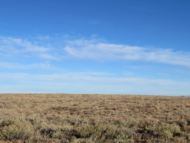
What happens in a grassland at dawn?

Mountain mahogany

Mountain mahogany

The Steens are looking close! They are about 35 miles away as the raven flies in a straight line.

Hiking along at 8,000 feet elevation along a broad mountain plateau amid a sagebrush bunchgrass. Who do we see as we’re walking along?
Several sage grouse! Flushed from the sagebrush and flew away like awkward chickens. Note the black dot in the center of the picture. We were more than a hundred feet away and the flushing happened quickly, so I wasn’t ready to get a zoomed in picture.

Only a few patches of snow left from the storm a couple days ago.
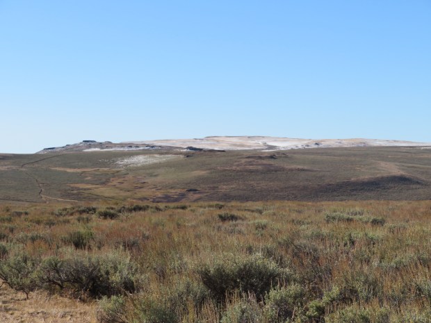
The high point (8,506 feet) of the Trout Creek Mountains still has a little snow.
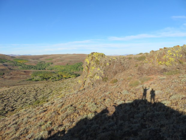
Team portrait.
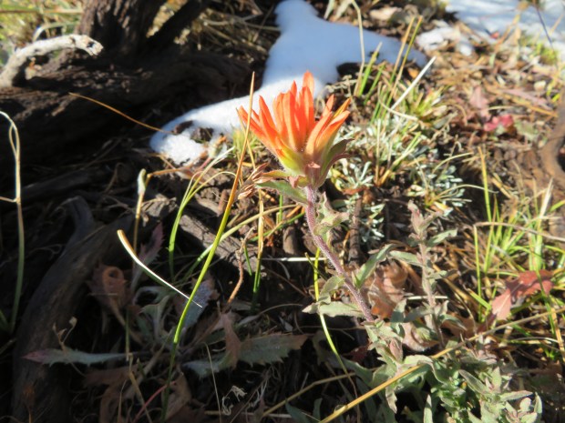
Paintbrush and snow patches – it’s autumn.
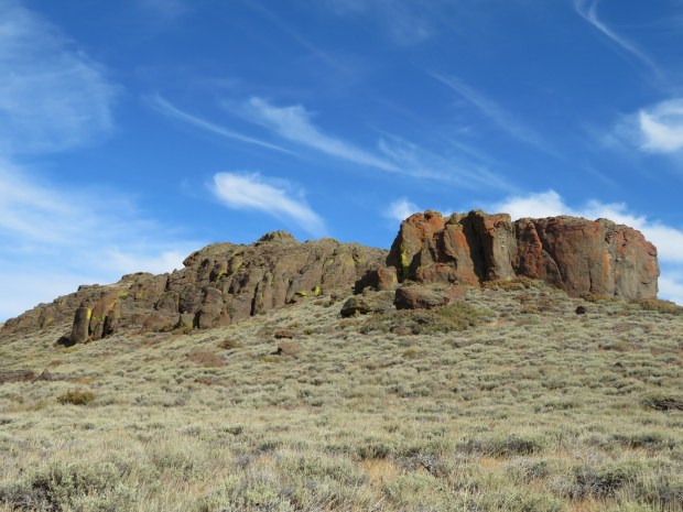
Rhyolite cliffs. A reminder that the Trout Creek and Oregon Canyon mountains – while in the northeast portion of the Basin and Range – are composed of a mix of rhyolite lavas and tuff from the McDermitt Volcanic Field (Owyhee Uplands) as well as basalt lavas from the Steens. A bit more geeking out since I just finished the geology segment of my Oregon State Master Naturalist class: Recent geochronology studies determined that the eruptions of the Steens flood basalts and rhyolite volcanism of the McDermitt Volcanic Field were likely contemporary geological processes occurring 16.5-15 million years ago (Benson et al. 2017). Caldera volcanism in the vicinity of the Steens Mountain dike form, suggests this area is the origin of the plumehead for the Yellowstone hotspot that is now in the proximity of Yellowstone National Park (because the North American Plate has drifted westward over the last 16 million years. (Source: Geology and 40Ar/39Ar geochronology of the middle Miocene McDermitt volcanic field, Oregon and Nevada: Silicic volcanism associated with propagating flood basalt dikes at initiation of the Yellowstone hotspot.)

Descending down Big Trout Creek. A namesake creek of the mountain range is known to provide habitat for the rare desert fish species such as the Lahontan cutthroat trout.
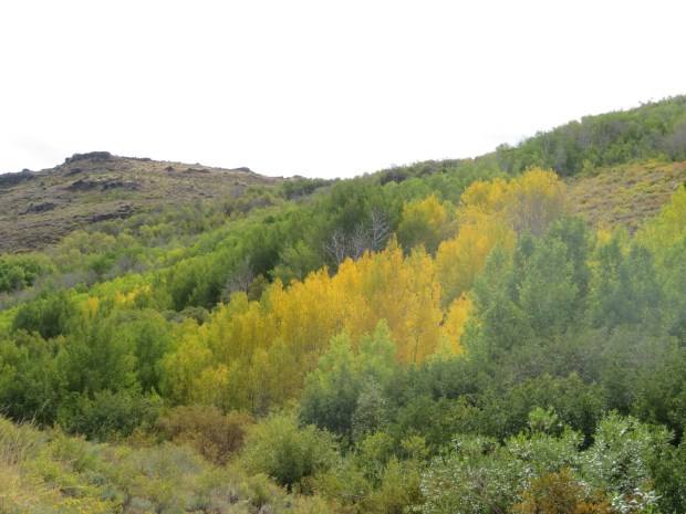
Aspen groves are starting to turn gold!

How lovely it is to stand beneath a golden aspen at watch its leaves quake and flutter.

Aspen, the best type of gold.

Even the snowberry (Symphoricarpos albus) is displaying its fall colors.

It feels like a golden fall day. I was excited here because we could also see the Alvord Desert! With Steens in view, we have great cell service with Verizon. I recall I was texting Gabriel’s mom about mailing us more SD cards so we could keep taking pictures.
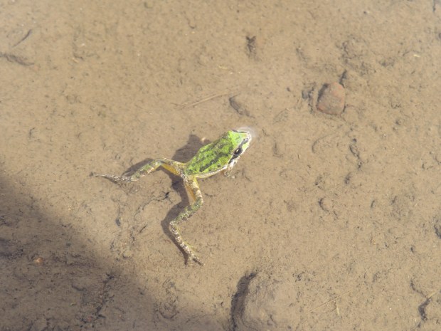
We met this charming Pacific tree frog (Pseudacris regilla) in a water trough near Catlow Peak.

Perfectly balanced on the rim of the same trough was this brilliant red scat!

It’s been cool the last few days and so we’ve been less attuned to rattlesnakes. This one was sunning itself on the road paralleling No Name Creek. It gave us a warning and then very slowly moved along. Sorry to bother you Rattlesnake! Thanks for making space for us to move by you!

Following a cattle trail down No Name Creek’s canyon. The day had been going so well. And then we saw those clouds and it started to feel ominous (to me anyway). The forecast had changed for the afternoon and thunderstorms were now a possibility. (I also checked the weather back when we had data in sight of Steens.)

Descending toward Little Windy Pass.

The Pueblo Mountains. At this point I was running in a crouched position to get down low as the black rain clouds, coming from the southwest, were moving in our direction.

Camp in Dry Creek. It rained a little on us while we were setting up, but the rains didn’t come down in earnest until we were in the tent. “Inside” we listened to thunder roar and saw lightning flash. I eventually put in ear plugs so I could sleep without hearing the thunder.
