
September 16, 2019, Day 12
Three Forks to Louse Canyon (beneath Overtime Reservoir) ~OC 67 , ~14.4 miles, ~146.5 miles total
Gabriel’s Day 12 pictures are here.
Rivers in deserts are magical. The Owyhee is magical. This is a beautiful place to be. It’s tempting to linger at Three Forks. To explore a bit up each confluence canyon of the river. To wade over to the hot springs for a soak. To admire the changing colors of the rhyolite cliffs with their shades of patina and lichen collages. To sit, with gaze lifted up to note geese and herons flying over and marvel as swallows swoop. To watch the light change on the river as fish rise. To observe how a day unfolds for the wildlife residents of this beautiful canyon.
Another time. This time we’re self-commissioned to head up the West Little Owyhee. We know that the next four days and 80-some miles are no cake walk. So we take in as much of the Three Forks magic as we can while we keep moving, lured on by the mysteries and myths ahead. (Gabriel is right, I am a conflicted thru-hiker.)
We did stop earlier than normal for breakfast this morning so we could enjoy views of Three Forks Dome and the short segment of narrows along the main fork of the Owyhee. Then it was several miles of road walking to get to Five Bar and the confluence with the West Little Owyhee River.
Cloudy skies filtered the sun and its warmth. I couldn’t help but have a dose of wishful thinking that it would have been nice to have 90-degree weather on this stretch of the ODT! But that’s not to be. It’ll be in the 60s or low 70s today and tomorrow with a chance of showers in the forecast. Not ideal conditions, but not horrible either.
From the road along Brown Ridge we could see hints of the canyon realm we’d soon be entering, grassy uplands rolling over steep cliffs, but no hint of how deep. After a few toe touches with the river and peekaboo views from the rim, we’re excited to spend multiple days in the canyon! The West Little Owyhee River and Louse Canyon have earned such superlatives as a national Wild and Scenic River (for its entire 63.1 miles), rugged, remote, and rarely visited. A part of Oregon with canyon narrows, buff cliffs, and terrain akin to southern Utah (not in rock age mind you). Our curiosity has been piqued for years. We’ve been anticipating this introduction.
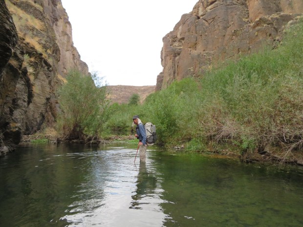
The descent to the river near Five Bar held all the thrills of walking into a beautiful canyon. Spires and pinnacles of marvelous form, colorful lichens, shadows of ravens on canyon walls, canyon wren trills, and the suggestion of hidden secret delights, small and marvelous. We forded the Owyhee River, where it was just above the knee deep. Thankfully, no flailing or swimming in a swift current required as is the case for spring ODT travlers. After a snack break at the confluence, we headed up the West Little Owyhee River.
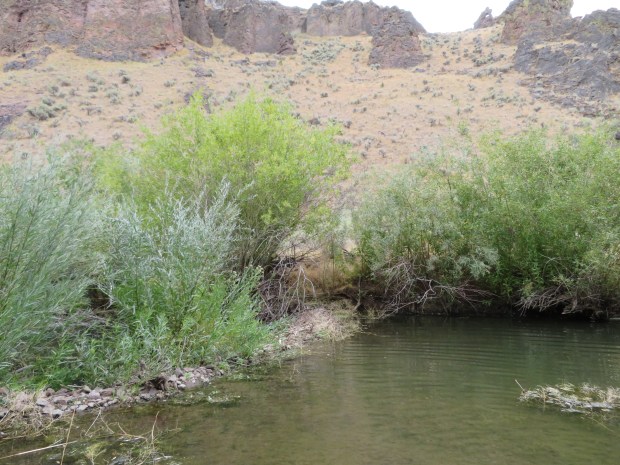
With every bend we were curious what we’d see next. Wash strolling. Beaver pool wading. Willow schwacking. Boulder negotiating. All the primary skills of canyon travel used. The West Little Owyhee River and Louse Canyon terrain features feel similar to parts of Kanab Canyon in Arizona.
Normally we like to hike until dusk to make the most of daylight. But as we traveled further up canyon the clouds rolled in and suggested rain was coming. The part of Louse Canyon we were in is more bouldery, narrow at times, with few level spots big enough for our tent. We couldn’t be choosy. So we started looking for home earlier than normal. We even did the rare thing of backtracking a bit to a spot we’d seen earlier (we hardly ever backtrack on a thru-hike!). A sandy bench cozied up to a juniper. We used river rocks to pitch our mid (free standing tents are heavy but have advantages at times) and got inside just as the rains started in earnest.
It rains 6 out of 12 days on the Oregon Desert Trail. (And three of those dry days were in Nampa.)

Morning at Three Forks.
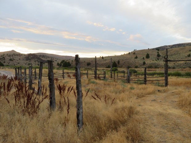
The old corral.
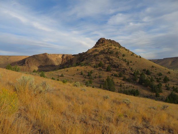
Three Forks Dome.
Nice breakfast views! Nice rhyolite. There’s a river and a hot spring down there somewhere.
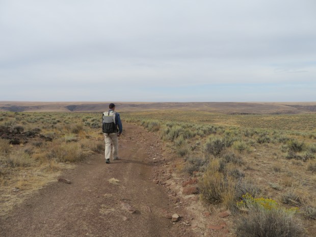
After the grandeur of Three Forks there’s several miles of road walking along Brown Ridge to get to the West Little Owyhee River – but you can see Owyhee Canyon in the distance! Some people walk up the river to the confluence. All sorts of ways to go. I think a really fun way to cover this section would be with a pack raft! Oh and as section hike or loop so that you aren’t carrying so much food with you or feeling the need to move on through.

Descending down an old wagon road toward the Five Bar area and Owyhee Canyon.

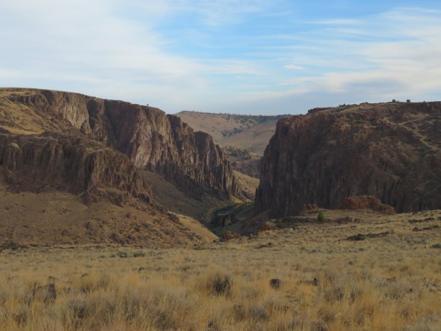
Owyhee River & Canyon.

Gabriel had a knee deep ford across the Owyhee River. I’m glad we didn’t have to swim through cold, fast spring flows here.

Crossing the Owyhee River. Photo by Gabriel Deal

Mukmuk likes the rhyolite cliffs!

Heading up the West Little Owyhee River.

A fellow canyon traveler.
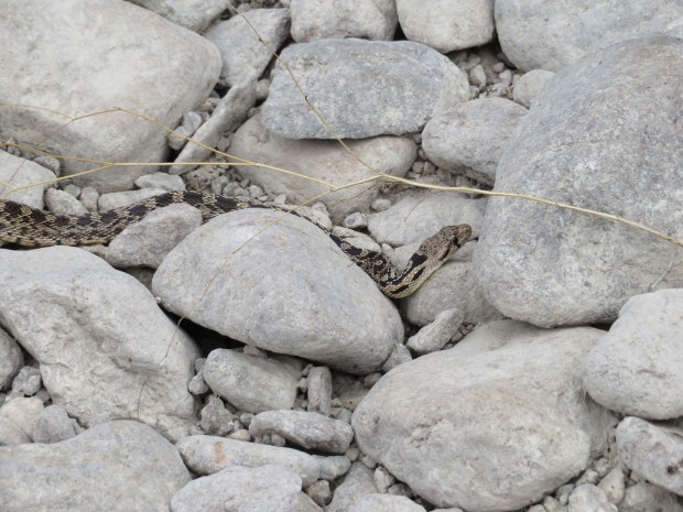
There were quite a few snakes around here, some of them were even swimming in the pools of water. This gopher snake was just moving along with skill amid all the cobbles.
Pools of water to wade across, thanks be to…

Beaver! It is so EXCITING and wonderful to know there are beaver here in the canyon doing their beaver thing to slow the flow of water, store water in the ground, grow more willow thickets, and cultivate the desert for all sorts of creatures – like frogs, crawfish, and fish. These beaver ponds contribute greatly to the health of the canyon ecosystem! (Yes, I’m a Beaver Believer… not that surprising. ;-D )

Though traveling through willow thickets isn’t my top choice for fun. This was an easier stretch. I eventually lost my sun umbrella to the willows of Louse Canyon. A sacrifice made. Next time, I’ll stash my umbrella inside my pack.
Sometimes the easiest way to move up canyon is wading through a beaver pond. Other times when the ponds are especially deep – it’s easiest to walk on top of beaver dams.
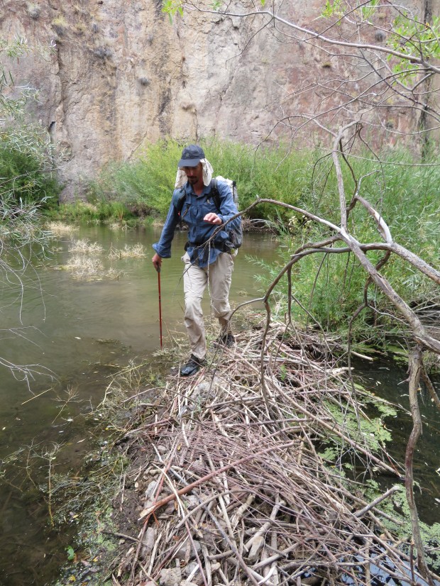
Gabriel crosses the dam.

But the going isn’t always straight forward out of the creek either.

But sometimes there’s easy wash walking.

Traveling through the West Little Owyhee canyon can be a stroll! (Sometimes.)

Image what it’s like around here when the river is at peak flows. This scour pool really makes me want to learn more about fluvial geomorphology! (More info on the study of the form and function of streams and the interaction between streams and the landscape around them can be found here: NPS Fluvial Landforms!)

- Nearing the fork for Louse Canyon – it’s on the right in this picture.

Upon entering the Louse Canyon fork of the West Little Owyhee the walking gets a little more interesting.

It even requires some mellow scrambling.

We’re not the only ones who have gone this way recently. Even if we can’t see them, the bighorn sheep are here!

The clouds suggest that it’s gonna rain soon. Even though we’d like to keep walking for a few more hours, it’s time to find a spot so we can set up the tent. That’s not a given in this part of the canyon and the next few bends look narrow and rocky – so we can’t be too picky.

We found a spot! And got our gear in the tent just before the rains started. Photo by Gabriel Deal
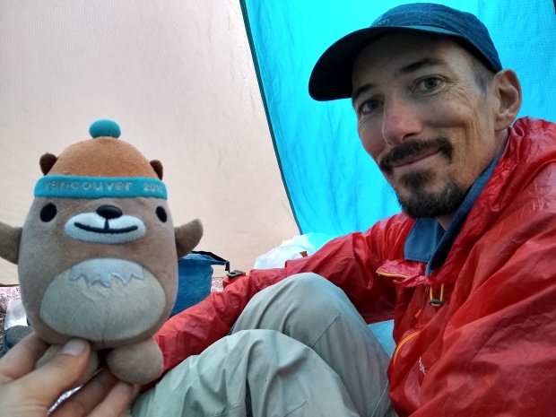
Mukmuk and Gabriel are nice and dry!

It rains 6 out of 12 days on the Oregon Desert Trail. (And three of those dry days were in Nampa and Boise. :/)
