
September 15, 2019, Day 11
Grassy rise near Dry Creek (OC 98) to Three Forks, ~23.9 miles, ~132.1 miles total
Gabriel’s Day 11 pictures are here.
When we last looked at a weather report, today was forecast to be another warm one (temps in the high 80s or 90s). We also wanted to make it to our next water source: Three Forks. A destination some 20 miles away with a big cross country component. So we got up and were moving before sunrise, walking gravel roads by moonlight. It felt good to start the day feeling a tad cool (we even kept our wind shirts on).
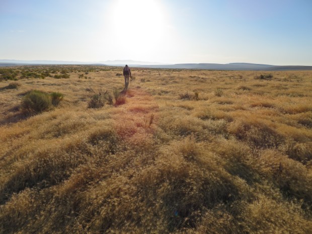
In optimal temperatures such as this morning, the world feels fresh and it’s easy to take in the vistas and pay attention to the sights at your feet. While going cross country, I stooped to admire buckwheats and grasses (forget about the heavy pack on my shoulders, I must botanize!). We saw a burrowing owl! And watched two pronghorn race by us! Such desert morning delights!
By 8:30 the sun was high enough in the sky that it felt warm. We had breakfast in some sagebrush shade along the banks of Soldier Creek – where to our surprise there was water accompanied by mallards, cliff swallows, finches, and a chorus of song birds.
After breakfast it was more cross country travel – looking down at one’s feet constantly to avoid cryptobiotic soils, stopping every few hundred feet to adjust the sun umbrella and make sure we were still going in the right direction, on lines with minimal impact. Sometimes with views of the canyon. But most of our concentration was taken up with moving well.
We were feeling ready to be in the canyon, not just looking at it. Our maps showed that the ODT’s cross country route parallels the road down to Three Forks for 15 or so miles – and at most it’s a mile from the road. (Such silly armchair route planning nonsense!) Given that information, we beelined for the road. We’ll save the effort of cross country travel for when it really counts. When it’s the only way to go. When we don’t have five days of food on our backs and some hundred-plus miles to go.
As we were traversing toward the road, we saw smoke clouds in the direction we were moving. Hmm… The last few weeks have mostly been hot and dry and the forecast called for a Red Flag Warning. So no surprise that there are wildfires burning, but are we going to be inhaling smoke or going by a fire as we move closer to the canyon? (That’s happened on other thru-hikes.) I still had a bar of data (for what would be the last time for several days) and learned that there was a wildfire burning in… Idaho. 32 miles south-southeast of Jordan Valley, OR. We’re roughly 32 miles south of Jordan Valley… Thankfully the fire in Idaho is more than 8 miles to the east of Three Forks. But it loomed large in our sightline for hours.
Over the rest of the day, the bright blue skies turned overcast and hazy with wildfire smoke. But smoke coming from fires in northern California. It was a little foreboding – the orange and red outcroppings of rhyolite above the canyon became tinted in dark brown and gray. The skies gray as if a storm was moving in.
At least the cloudy skies kept the temps cool. We kept road walking all afternoon. Some miles flew by, some miles dragged by. A few cars drove by us, two even stopped to ask if we were all right and gave us some extra water. Yay for trail magic! Thank you kind travelers!
By early evening, the winds picked up, the smoke haze was coming in thick, it was obscuring views at times. But we were getting oh so close! Some four miles of cross country and old jeep tracks later we descended to the storied, pictured place in ONDA imagery, and starting point for many a boater and backpacker trip report: Three Forks.
Ahh, Three Forks – confluence of the Owyhee, the North Fork Owyhee, and the Middle Fork Owyhee Rivers. Staging site during the 1860s Snake War, when the American military was pushing the Northern Paiute, Bannock, and Shoshone peoples from their homelands in this area. Today these First Peoples are still here… along with ranchers, homesteaders, and a growing contingent of recreation enthusiasts.
But tonight it is a quiet, peaceful oasis out of the wind. Hillsides of bunchgrasses and sunflowers are still. Sounds of the river calm and unhurried. The smell of willow and rushes tell of abundant water. This is our resting place for the night.
Only one other party is camped in the area. They are close to the river. Gabriel chatted with them when he went down to get water. The couple, from the Oregon Coast, love to come to the desert in late summer/early fall for a week each year. I think the Oregon Coast and the Owyhee Canyonlands are two (of many) exceptionally beautiful parts of Oregon, but so far apart in character and travel time. Both fantastic places to be for a few days or a lifetime. There’s so much to love in Oregon.

Walking by moonlight is beautiful. And a reasonable option because the first few miles of the day are on roads.

Waiting for the sun to rise.

Hitching knots to replicate when closing the gate.

Off trail time with some mellow cross country walking. We saw a burrowing owl nearby!
And now the sun is out and the day is starting to feel warm.
Looking down toward Soldier Creek.
Descending to Solider Creek and water! There were ducks wading in a pool and cliff swallows looping and swirling around the rimrock – this was a lovely hotspot of bird activity.

Walking along a dry rocky stretch of Soldier Creek.

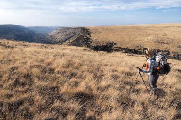
Out of Soldier Creek it was cross country at times along the Soldier Creek V. Miles of rabbitbrush, sagebrush, bunchgrasses, biocrust, and rolly lava rocks. Interesting sometimes. At times tedious. It’s hard mentally to trod and compress ground when so much of the area is already compacted – there were plenty of cow hammered reservoirs around. So when our route neared the road down to Three Forks we switched over for ease, to reduce our impact, and knowing we had a hundred-some miles to cover. I really think this part of the ODT warrants section hiking with a mindset of exploration vs the practicalities of getting through. I’d prefer to dabble in the uplands, then take loop trips down side canyons to the river.

Road walking all afternoon in a terrain of gentle rises and distant views. This bend in the road was exciting for its novelty – a sharp turn!

Still road walking.

At last! Cross country time that’s not paralleling a road.

Walking cross country through medusahead rye and negotiating lava rocks – big ones are easier to walk around than the ankle roller ones.
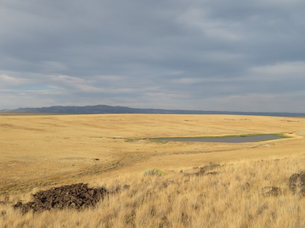
Long Canyon Reservoir #2.
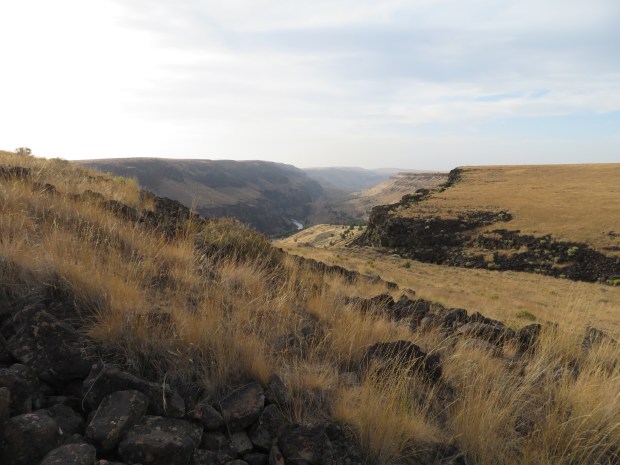
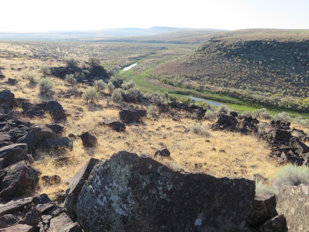
A glimpse of Owyhee Canyon and its river.
Beautiful bunchgrasses on this side of Long Canyon. Photo by Gabriel Deal

Smoke from fires in California and Idaho haze the views as we approach Three Forks.
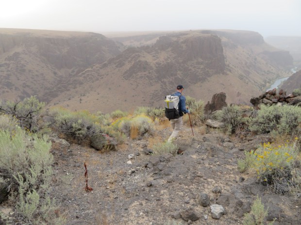
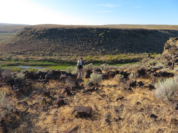
Descending down to Three Forks.
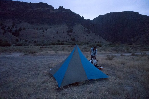
Camping at Three Forks. We set up our tent for the night because we weren’t sure if the smoke may also be mixed with rain clouds. And there was one other party camped in the area. Three Forks is a campground and major destination in the area. This would be the only night we’d camp near anyone on this trip. Photo by Gabriel Deal
