
September 5, 2019, Day 1
Lake Owyhee State Park to North Sheephead Spring, ~9.3 miles
Gabriel’s Day 1 pictures are here.
Friends of the Owyhee ED Tim Davis picked us up this morning and took us to the eastern terminus of the ODT. It was really special to get a ride from Tim and a fitting start to the trip – offering more context for place than the minutiae of typical trail talk.
Tim grew up in Malheur County and recognizes how special and spectacular the Owyhee country is. He’s been able to see opportunities for ranchers, recreational enthusiasts, and conservationists to come to the table to share knowledge and use science for improving and sustaining this place for a variety of needs and interests. (Note, ranchers, conservationists, and recreation enthusiasts CAN be one in the same. Sometimes I think we need less labels and talk of “they” and more conversations over coffee about why we all care about a place, a thing, an idea so we can get beyond our judgments and preconceived notions.)
It was a beautiful drive out to Lake Owyhee Reservoir. From the road we had views of the rolling foothills of Blackjack Butte and outcroppings of basalt above the meandering river. Already, I think one could add at least 20 more miles to the ODT through such fantastic country!
Driving above the dam and setting our sights on the blue waters of the reservoir reflecting the gold hills was a bit of thrill, knowing WE ARE HERE! The eastern terminus of the ODT. A place I’ve long dreamed of being. Thank you so much Tim for the ride! Thinking good thoughts for FOTO and looking forward to supporting your efforts in the future.
After taking our obligatory pictures at the terminus and getting our things in order Gabriel and I set out. Umbrellas up within 10 minutes. Today the high was supposed to be around 93 degrees F, likely the warmest day of the trip. It sure felt darn warm by 10 am.
We new that this being our first day on a long journey, it is all about acclimatizing to 5-days of gear in our packs, walking all day, hot temps, arid conditions, extra water for said temps and conditions, etc. We took it easy, breaking in every smidgen of shade and using our umbrellas where there wasn’t any. We dripped and glistened with sweat. I kinda think instead of drinking a liter of water, I could have just poured down my back, because that’s where it ends up. Every hour, we took salt tabs. I kept thinking of Allgood saying they ate electrolyte tabs like they were Pez.
Day one in more arid hiking conditions is always and adjustment.
After gaining the grassy uplands via a road we set off cross-country through bunchgrass and lava rock hillsides, sometimes finding cattle trails to make the walking easier. The rabbitbrush is starting to flower and turn the hills bright yellow. Already we’ve watched pronghorn zoom across the grasslands ahead of us. Speeding along then stopping to watch us. Then dashing off over the rise. So curious. Always alert. Oh, how I love being in pronghorn country!
By late afternoon we made it to Rookie Canyon Spring and met our first cattle of the trail. The three Angus amigos who were very polite and let us fill up on cold delicious water from their trough. I suspect I’ll have to stop counting cows here in a day or so, cause the herds will be bigger.
As we headed over to Sheephead Ridge we noticed blue and black clouds and rain cells to the west. They were moving in our direction. We dropped off the ridge as thunder started to roll across the land. We went down as low in terrain as we could get, stopping near a spring and with a tractor tire pond. A rain cell burst over us a few minutes after we found a place to camp.
We’re using our Black Diamond mega mid for this trip, so we were able to set up our tent over our gear pretty quickly; keeping us from getting drenched and our gear dry. Turns out, it’s hot, then it’s damp here in the desert.
Allgood said it rained only one day of his ODT hike last year, I wonder if this is “it” for the rain for us.

Tim kindly helps ODT hikers get to the terminus when he can and decorated his rig accordingly.

Team portrait on the eastern terminus of the ODT. Looking at the waters in Lake Owyhee (actually it’s a man-made reservoir along the Owyhee River).

A rare selfie…

Mukmuk and the way up to the Owyhee Uplands.

Getting water at Rookie Canyon Spring.

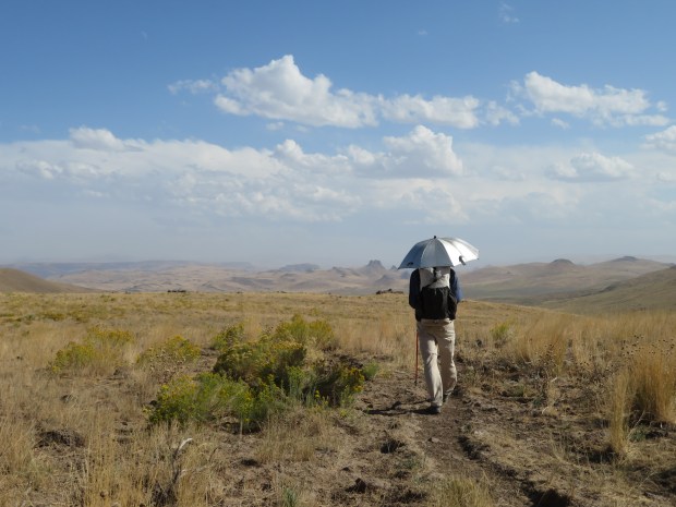
Typical views along the ODT: rolling hills, sagebrush, bunchgrasses, and cloud shows.
Pictures from my camera added to the post in April 2020.

It looks dry up there! Views of the Owyhee Uplands as we hike up an old road away from the water of Lake Owyhee reservoir.

Sunflowers and sun umbrellas.

Taking a baring as cross country navigation begins.

Cross country striding with portable shade. It’s not hard walking but we are having to keep our eyes open for biocrust, rattlesnakes, trippy volcanic lava rocks (a reminder of the processes that formed the Owyhee Uplands).
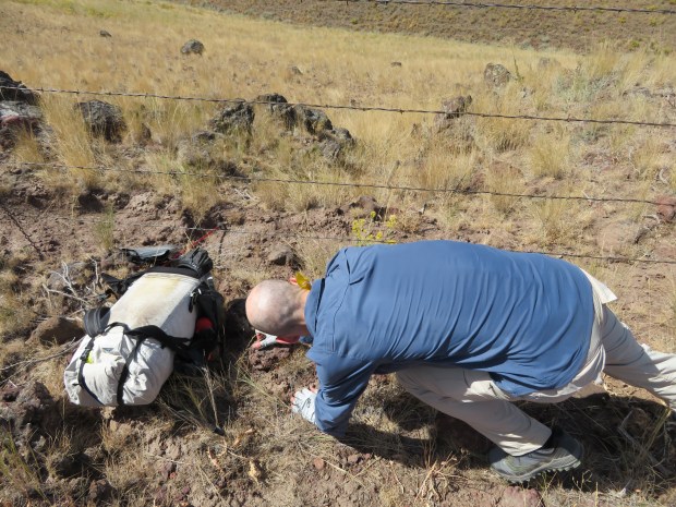
The first barbed wire fence of the trail

Almost there!
Beautiful vistas – including Three Fingers Rock near Succor Creek.

Clean cold water from Rookie Canyon Spring.

A change in the sky as we head toward Sheephead Ridge. Wonder what’s on the other side.

The other side of Sheephead Ridge. Where is that storm system going? Time to get low.

Rain drops falling on the tent and not on our heads.
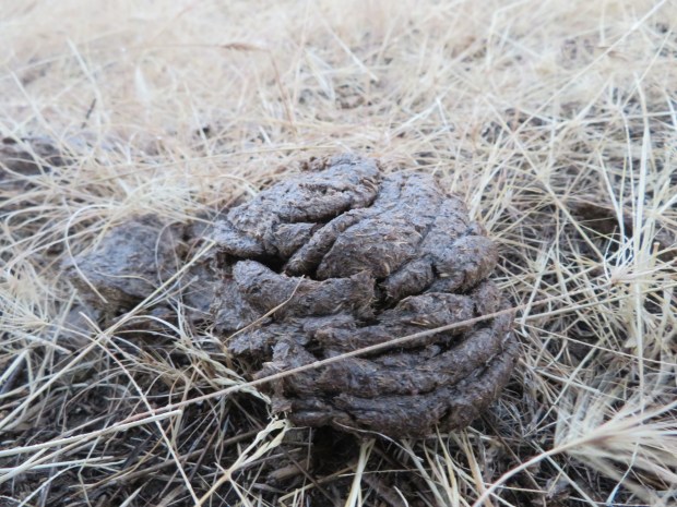
Our camp has the cow stamp of approval. Oh the smell of wet old cow pies.

Off to a good start! Enjoy a safe and awesome trip!