
We woke up in the wash reminded that camping in a wash can mean condensation. Damp sleeping bags. Not a big deal, but it’s still the first week of service for my new Enlightened Equipment 10 degree F down quilt. I wasn’t ready for it to suffer. We’ll just need to remember to stop and dry out our gear. Perhaps at breakfast?
Otherwise a beautiful morning wandering down the canyon and onto a grassy bench to enter another arm of Lockhart Canyon. Our morning was cool and going smoothly. Which was good as we felt a little time crunched to make our schedule. One for our Canyonlands NP permit, two for Gabriel running low on food (his hiking appetite has already kicked in). So we didn’t fully consider gathering pothole water until we walked by a seep on the map noted as a water source that turned out to be dry.
Oh bother. Time to assess our options. With no guarantee of water (other than really alkaline sources) between us and our next resupply at Needles Outpost, we thought to play it cautious. Our next for sure water is 24-30 miles away, Hayduke style; not CDT or PCT cruiser mile style. What if it took us more than two days to get there? A gallon a day is the general recommendation. We needed to get two gallons apiece. Better safe than sorry.
Our smart and safe option was a 4-mile round trip walk to the Colorado River. 😛 Down the sandy road we went. At least the morning was cool and we hoped to have breakfast in a pretty place. The trade off for such effort to get water: how much time would it take?
A fast walk down the bends to the river found us bashing through tamarisk to get to the water. To have maximum capacity of eight liters apiece we ate our breakfast in a thicket of pokey, rotting tamarisk (so much for a pretty view, Gabriel will have to share the pictures with me). Then we pounded down a liter each. All bottles and Platys empty, we filled up all our containers with the murky brown, life sustaining, not-so-alkaline water of the Colorado River.
Eight liters each, a little over two gallons apiece. Instantly adding 16+ pounds to our packs. We could feel the weight mentally and physically. The not so bad sandy road down to the river now felt like a slog. While we carry more weight for many a climb or ski trip, but we are in light weight hiking mode, so psychology this is a bit of a challenge. And reality is that 16 pounds of additional weight certainly slows the pace.
Now that we had water security, the question became do we have enough time and food to meet our Needles Outpost/Canyonlands NP schedule? With two route options before us, we told ourselves we’d evaluate the situation when we got to the point in Lockhart Basin where the routes split. Our original plan was to take Rustler Canyon into Indian Creek and come into Canyonlands that way, it has some scrambling and sounded beautiful. Our other option: keep following the Lockhart Basin road to the road into Indian Creek and take that to Needles Outpost; likely longer miles-wise, but far easier to travel.
The day got warm. The roads stayed sandy. Most of the shade had cow pies. And we did come upon water, but it was rimmed in alkaline salts. Lockhart Basin could have been exciting, parts of it are in the newly designated Bears Ears National Monument! Alas our warm day of road walking didn’t reveal the details. I know we didn’t get to pay this area its due respect.
We got to our turn off point and knew the cautious thing to do was take the road route. But after so many miles on road, I felt like we were missing out. Still, practically wins. Food and water security are important. Taking the road meant we had both.
I was bummed. And my shoulders hurt from a pack filled with water.
But soon we made the best of road walking. Talking about super heroes. Making games of following cow paths. Finally stopping to dry out our sleeping bags. Gabriel getting to eat as much as he wanted (which always makes me happy). And we saw three bighorn sheep along a rib of Moenkopi rock above the road!!!
This route has its own perks afterall.
By camping hour, we were just dipping into Indian Creek’s canyons. A light rain and sun dropping below the clouds lit up a double rainbow from Hatch Point Mesa out toward the Needles of Canyonlands.
We found home for the night near a pinyon pine with a slickrock ledge for a dinner spot. Views of the Six Shooter peaks, Manti mountains, Hatch and Hart mesas aglow. No longer missing what we didn’t see, but enjoying where we were.
Day 5: 20.5 miles, 83.2 miles total. Tributary canyon of Lockhart Canyon near 4352T to the road into Indian Creek.
GPS: used twice; people sighted: many nice ATVers; roads: it was almost all roads!
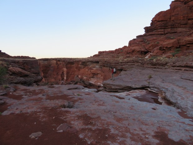
Gabriel checks out the big pouroff we can’t skirt. As Bugs Bunny would say, “Watch out for that first step! It’s a loo-loo!” Time to follow a grassy bench over to the next canyon.
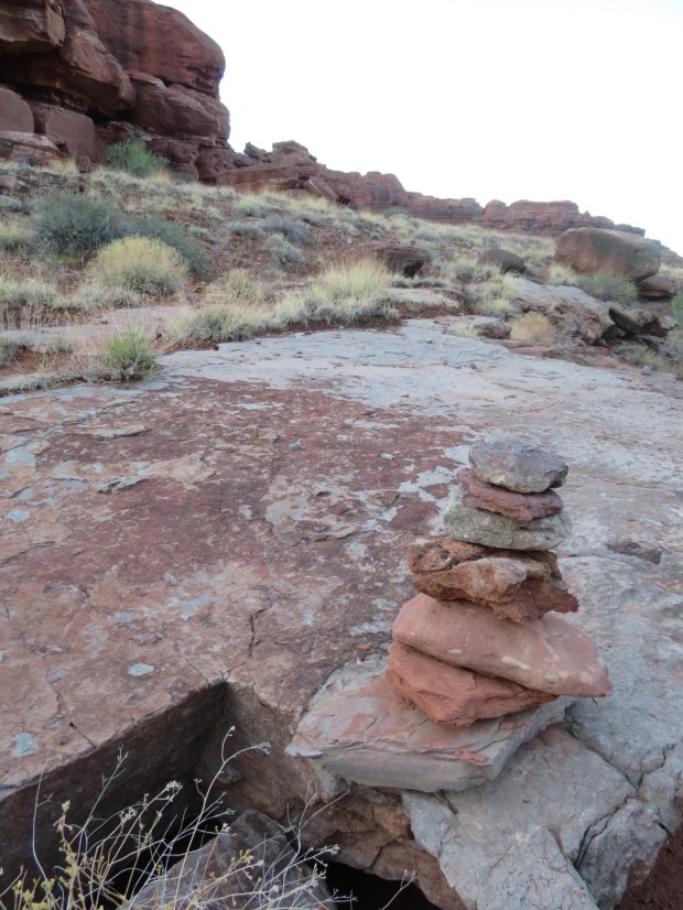
There is many a cairn along this route. We wonder who else uses this path.
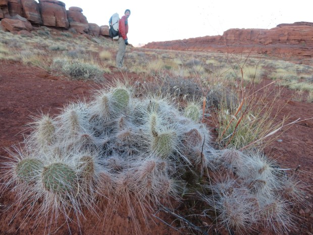
A very prickly prickly pear cactus!

The sun warming up the day on a bench above Lockhart Canyon.
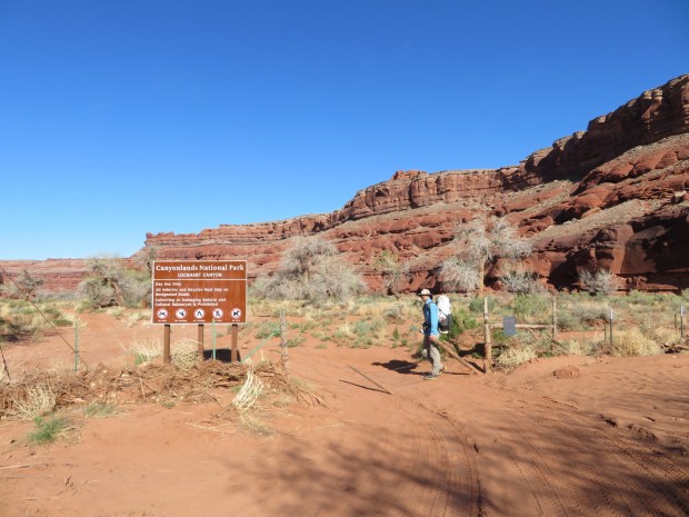
We crossed into Canyonlands NP to access the Colorado River.
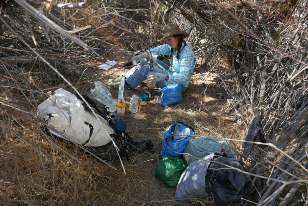
Breakfast in the tamarisk. I don’t think we will be drying our sleeping bags out here.
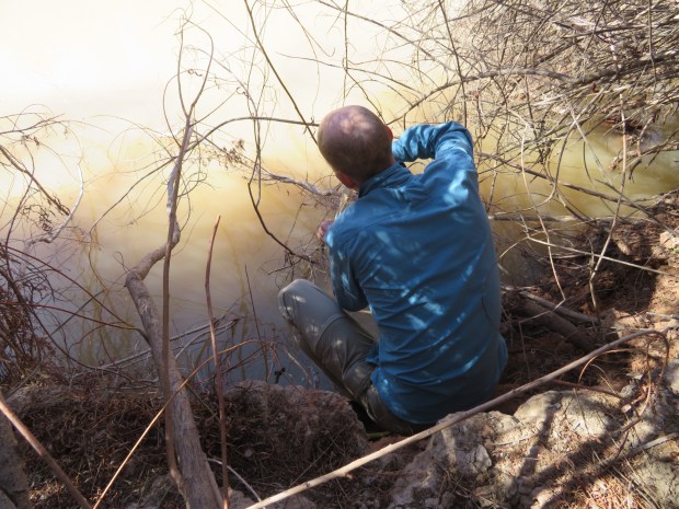
Gabriel gingerly balances on a muddy bank to collect our water. I ducked through the tamarisk to set him up with containers and get our filter system going. The tamarisk drew blood from both of us!
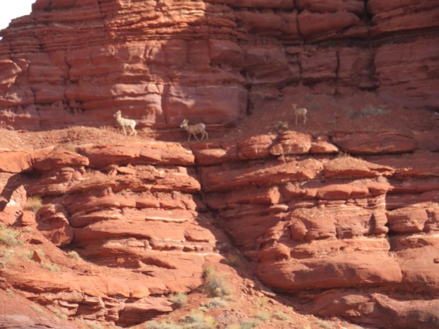
Three bighorn sheep!

We walk and filter on the go.
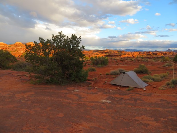
Camp on slickrock with a pinyon pine neighbor and a nice dinner time view.

nice filtration system, nice bighorn sheep. I’m getting behind reading your posts but catching up tonight