
All night the wind howled in the tree tops. But it was calm (and dust free) on the forest floor. The last forecast we read noted winds 15 to 20 mph. Late afternoon gusts to 40 mph… hmmm. Get up and over was the plan.
Hiking over the Henry Mountains is a treat when conditions allow. The 11,400 foot high point of Mt. Ellen’s south ridge is the high point of the Hayduke route. Views east extend to the Sierra La Sal and the start of the route. The views west to the Waterpocket Fold and beyond!
I’d hoped to add in a hike to the true high point of Mt. Ellen (11,522 feet), fulfill my inner peak lover. But not this day. With the wind, we were fortunate to hike over the ridge. More like the wind tried to knock us down, then gave up, and blew us over.
Our route up followed the road for a few miles through little drifts of snow. We saw Douglas-fir, Ponderosa, Engleman spruce, white fir, aspen, and eventually limber pine! I learned of a new favorite plant association group: oak and sagebrush! The chipmunks and the turkeys were out too.
Before Wickiup Pass we left the road to ascend the ridge of the Granite Ledges. Nice steep, progress making walking! Eventually our up route crossed another road and we traversed the south ridge. Easy enough. Decent snow in places. Not too postholey. But the wind!
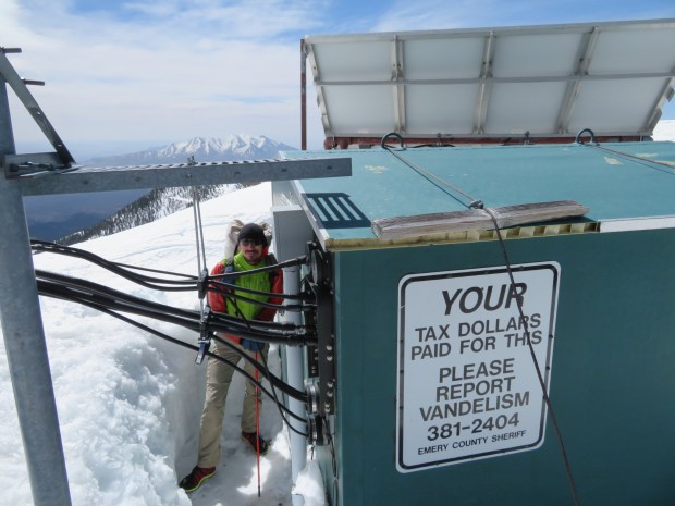
Our hoods flapped like jackhammers, constantly. We staggered in the gusts. And leaned into the wind. No time to linger on the high point. We staggered up and over. Views to the east were a dusty haze, anyway. We hunkered down behind a radio tower building to warm up, calorie up, and most importantly get out of the wind.
Then we strated our descent on the southwest ridge. Bracing ourselves in the gusts. A few hundred feet down conditions improved. And our minds calmed with the end of the jackhammering.
To our surprise, we saw the miners working in Bromide Basin. A high point is nice, but we weren’t expecting these mountains, “the last mapped in the lower 48” to be so fully utilized. Mining, road networks, cattle grazing, timber harvest, radio towers. Mt. Ellen (named for John Wesley Powell’s sister) is a mountain dedicated to resource use. Perhaps the southern Henry Mountains are more wild. But not for us to find out today.
Descending out of the wind, we dropped into the drainage of Sweetwater Creek. Calming our ears. Rested. Got some water. And a little extra, the next few sources can be dry or less ideal. Depending, a 16 to 30 mile water carry. Gabriel remembered how back on the PCT we thought 16 miles was a long way.
We kept descending a mix of cattle trails, hiker tracks, and the fall line down below the pinyon woodlands down to the juniper studded flats 4,800 feet below Mt. Ellen.
Eventually we walked onto the edge of Tarantula Mesa. Where the pinyon grove was once again warm and sheltered from the wind. Tonight we cowboy under juniper and pinyon.
Day 16: 15.9 miles; 238.5 miles total. Bench above Crescent Creek to pinyon woodland on the edge of Tarantula Mesa.
GPS: used once; people sighted: only operating the mining equipment; roads: a 40-60 mix between road and cross country.

The first snow of the trip. So cute!

Aspen, fir, and spruce grove near a flowing stream.

Views to the east from the south ridge of Mt. Ellen. On a clear day, we could see a lot of route!

Gabriel walking in the wind. Will share videos later.
Out of the wind for a few minutes!
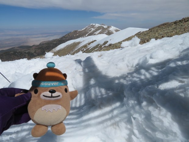
Mukmuk is enjoying the lee side of the radio shed.

Calorie time with chocolate coconut peanut butter squirrel butter!
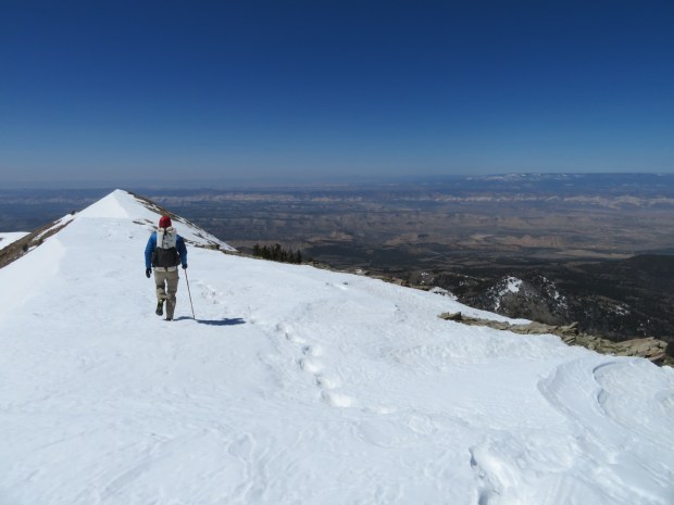
Descending with views to the west of the amazing places to come.

Getting water from the fresh snow melt of Sweetwater Creek.
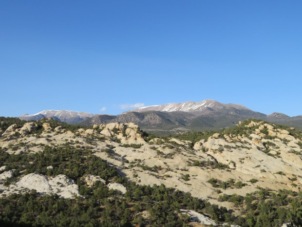
Looking back on the Henry Mountains. They look so calm from a few miles and almost 5,000 feet lower.
